Sometimes it’s hard to see how actions can affect outcomes, especially when dealing with transit planning. TransLoc Traveler gives agencies the ability to see THE FUTURE. Ok, maybe not. But it does allow agencies to see anonymized, real-time location information for their riders. For the first time ever, agencies can now gain a keen awareness of how riders actually use routes and stops to complete trips, from origin to destination.
Check out how our client NC State University (NCSU) used Traveler to inform their decision-making process, in a short, 3-act play:
ACT I: It’s time to plan for the fall.
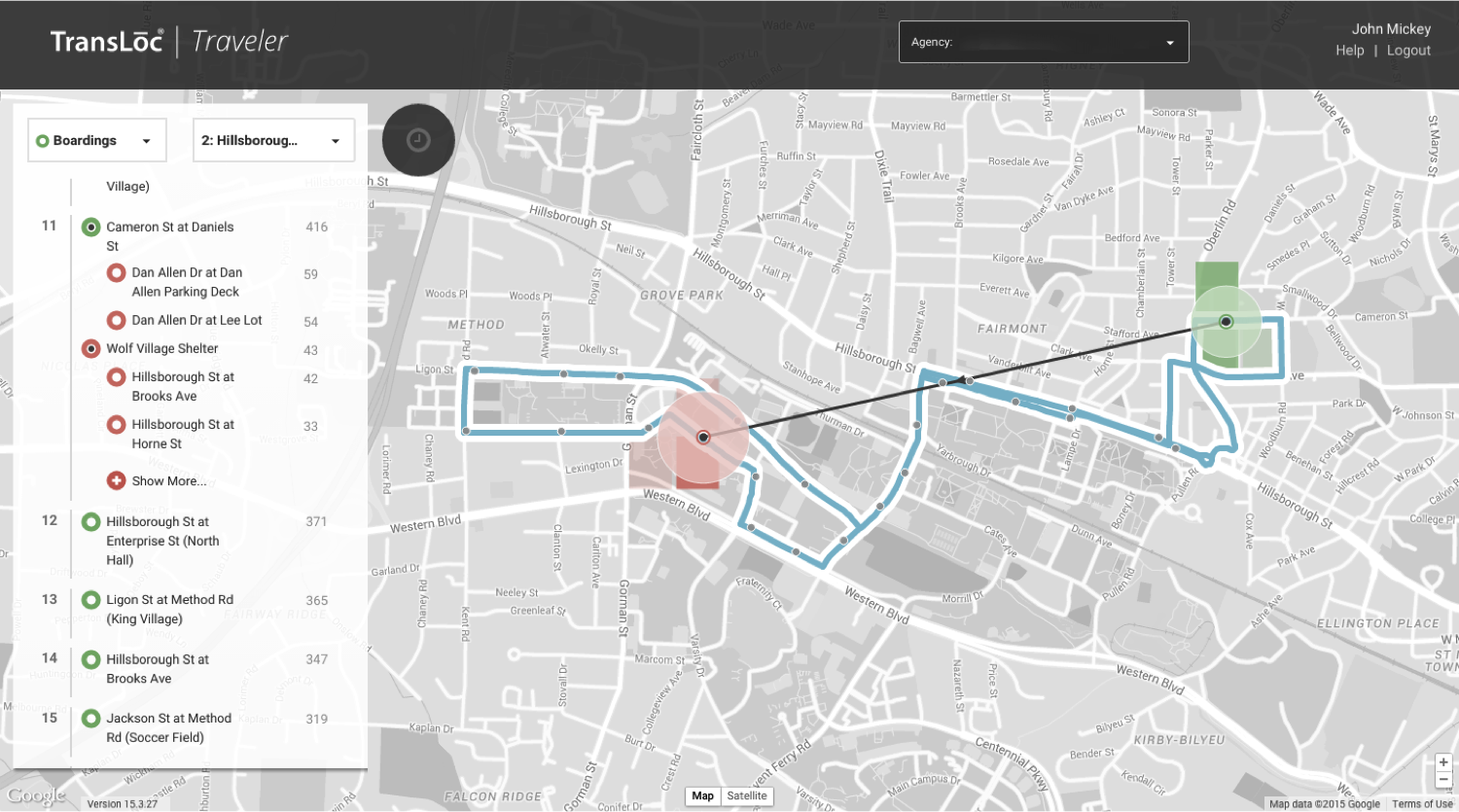
Every spring, NCSU plans out service for the new school year. They determine where to expand, maintain, and reduce service. This spring, Route 2: Hillsborough Street Shuttle was a top choice for service reduction. If reduced, the Route 2 line would no longer make the stop outside a shopping center known as Cameron Village. The NCSU Transportation planners didn’t think serving the Cameron Village shopping center was necessary for the route to be a success.

TransLoc Traveler showing the origins and destinations of riders using these stops along Route 2: Hillsborough Street Shuttle.
ACT II: “We were wrong.”
During their planning process, Michael Ousdahl and his team in the NCSU Transportation Department used TransLoc Traveler to study how riders actually used Route 2 and it wasn’t how they expected. During their analysis, Ousdahl found that residents of a popular apartment complex, Wolf Village Apartments, were using Route 2 to go to Cameron Village, and not just to have fun shopping. Using Traveler, Ousdahl could see that these residents were actually visiting the Harris Teeter grocery store and using the bus line to return home with their groceries—an insight they wouldn’t have gained without expensive onboard surveys, and possibly not even with those. A lot of service planning can be based on gut instinct or anecdote, but with Traveler they have access to the facts (origin-destination data).
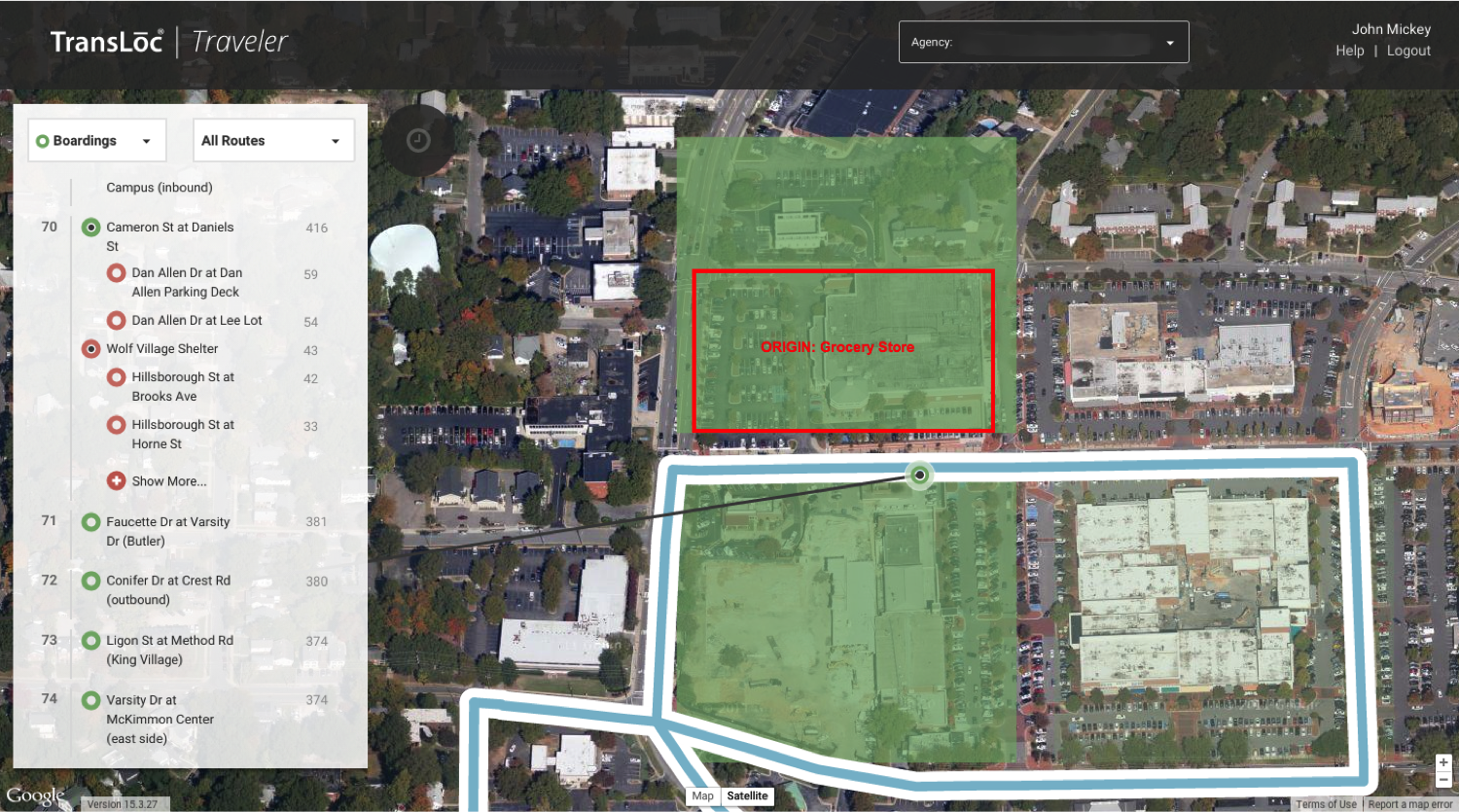
A close-up look showing the majority of riders for this stop originated at the Harris Teeter grocery store.
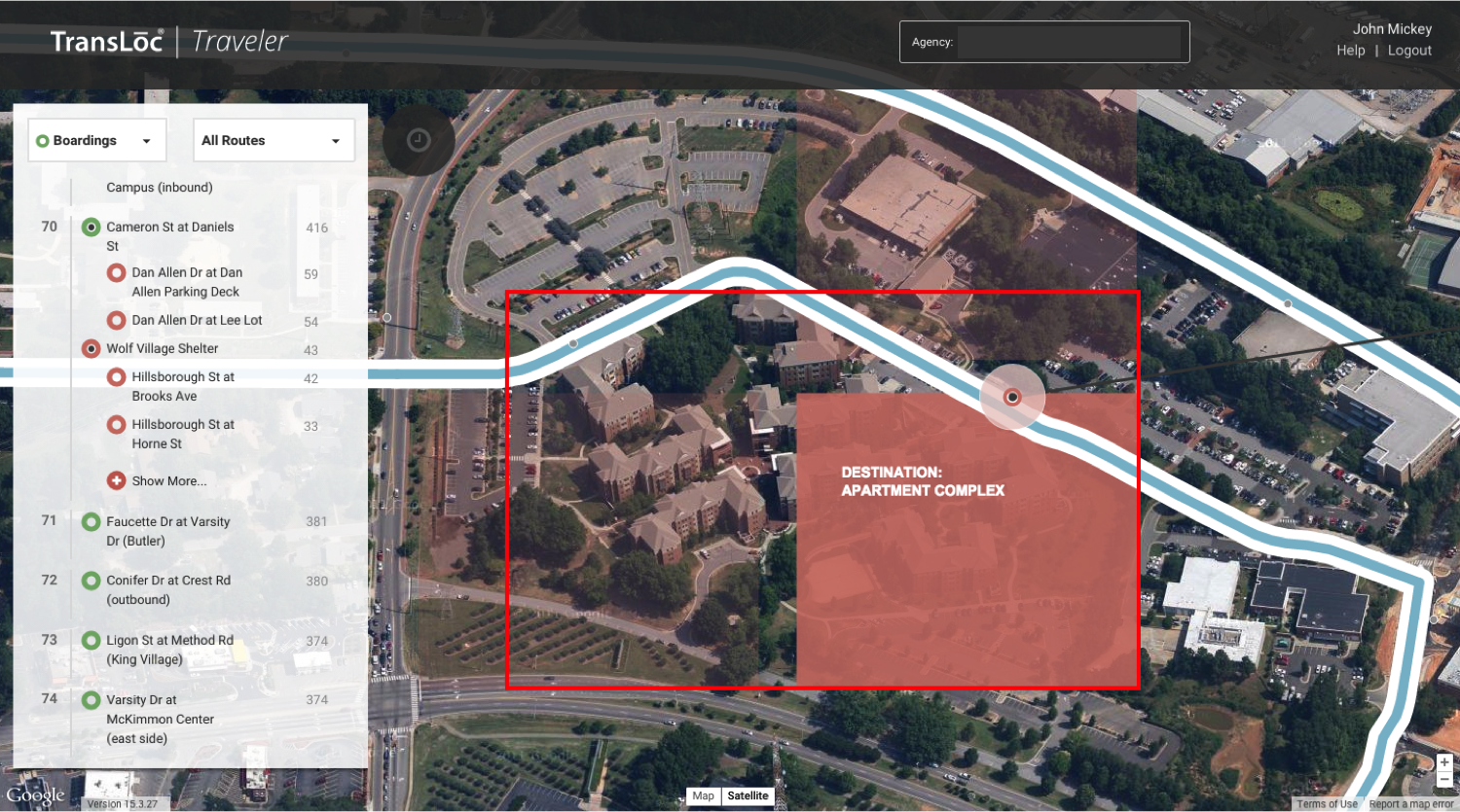
These riders ended up at the Wolf Village Apartment Complex, most likely with groceries.
ACT III: “What do we do now?”
Ousdahl and his team had a difficult to decision to make. Reducing service would decrease cost and increase route efficiency, but it would have the unexpected consequence of cutting off access to the grocery store for the Wolf Village residents. Ultimately, they decided not to reduce service because of what Traveler showed them about how their riders used Route 2 in real life.
The invaluable data TransLoc Traveler provides can give transit planners real insight about how their riders actually use their services, which means better service all around—we call that #winning.